
Advertisement
Sheffield City Council
Map of the Sheffield Council Area
The area shaded blue on the map represents the extent of Sheffield Council. The map pin represents the location of the council offices.
Waste Recycling Performance
298 (86.88%) of local authorities perform better than Sheffield Council.
44 (12.83%) of local authorities perform worse than Sheffield Council.
Sheffield Council has a population of 534,500.
Sheffield City Council is within the ceremonial county of South Yorkshire
click to enlarge
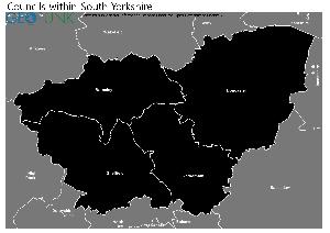
Download Print Quality PDF of Councils in South Yorkshire
Councils Neighbouring Sheffield Council
Wards within Sheffield City Council
click to enlarge
.jpg)
- Beauchief and Greenhill
- Beighton
- Birley
- Broomhill and Sharrow Vale
- Burngreave
- City
- Crookes and Crosspool
- Darnall
- Dore and Totley
- East Ecclesfield
- Ecclesall
- Firth Park
- Fulwood
- Gleadless Valley
- Graves Park
- Hillsborough
- Manor Castle
- Mosborough
- Nether Edge and Sharrow
- Park and Arbourthorne
- Richmond
- Shiregreen and Brightside
- Southey
- Stannington
- Stocksbridge and Upper Don
- Walkley
- West Ecclesfield
- Woodhouse
Download Print Quality PDF of Wards in Sheffield City Council
Sheffield Council Contact Details
| Website | http://www.sheffield.gov.uk/ |
| Contact Us Page | http://www.sheffield.gov.uk/contactus |
| Address | Town Hall |
| Pinstone Street | |
| City | Sheffield |
| County | South Yorkshire |
| Postcode | S1 2HH |
| Telephone Number Description | General enquiries |
| Telephone Number | 0114 27 34567 |
| Main Contact Email | firstpoint@sheffield.gov.uk |
Details for Sheffield City Council
| Local Authority Name | Sheffield City Council |
| SNAC Code | 00CG |
| Postcode | S1 2HH |
| Latitude | 53.3803862334 |
| Longitude | -1.47000611347 |
| Country | England |
| NHS Health Authority | Yorkshire and the Humber |
| Parliamentary Constituency | Sheffield Central |
| European Electoral Region | Yorkshire and The Humber |
| Primary Care Trust | Sheffield |
| Region | Yorkshire and The Humber |
| Admin County | |
| ONS Code | E08000019 |
Political Make Up of Sheffield Council
| Type | CO |
|---|---|
| Party with overall control | Coalition: LAB/LD/GRN |
| Labour | 38 |
| Liberal Democrats | 29 |
| Conservative Party | 1 |
| Green Party | 14 |
| UK Independence Party | 0 |
| Plaid Cymru - The Party of Wales | 0 |
| Scottish National Party | 0 |
| Democratic Unionist Party | 0 |
| Sinn Féin | 0 |
| Ulster Unionist Party | 0 |
| Social Democratic and Labour Party | 0 |
| Traditional Unionist Voice | 0 |
| Progressive Unionist Party | 0 |
| Independent | 1 |
| Vacant | 1 |
| Electoral Cycle Start Date | 2016 |
| Electoral Cycle End Date | 2030 |
2022 Election Results for Sheffield Council
| Council Seats up for Election | Third |
|---|---|
| Labour | 39 |
| Liberal Democrats | 29 |
| Green Party | 14 |
| Conservatives | 1 |
| Others | 1 |
| Vacant Seats | 0 |
Waste and Recycling Rates for Sheffield Council 2017-18
Waste Recycling Performance
298 (86.88%) of local authorities perform better than Sheffield Council.
44 (12.83%) of local authorities perform worse than Sheffield Council.

| Authority Type | Unitary |
|---|---|
| Waste per household KG | 530.7 |
| Percentage of household waste sent for reuse, recycling or composting | 30.70% |
| Collected household waste per person (kg) | 324.2 |
Employee Headcount for Sheffield Council
FTE = Full Time Equivalent
| Region | Yorkshire and the Humber |
|---|---|
| Total Headcount | 11660 |
| Total FTE | 8770 |
| Male Full Time | 2287 |
| Female Full Time | 3359 |
| Male Part Time | 871 |
| Female Part Time | 5143 |
| Permanent | 10686 |
| Temporary/Casual | 974 |
| Male | 3158 |
| Female | 8502 |
| Full-time | 5646 |
| Part-Time | 6014 |
| Male Full Time perm | 2157 |
| Female Full Time perm | 3166 |
| Perm Male | 2864 |
| Perm Female | 7822 |
| Perm Full-time | 5323 |
| Perm Part-time | 5363 |
| Male total FTE perm | 2552 |
| Female total FTE perm | 5744 |
| Male Full Time temp | 130 |
| Female Full Time temp | 193 |
| Temp Male | 294 |
| Temp Female | 680 |
| Temp Full-time | 323 |
| Temp Part-time | 651 |
| Male total FTE temp | 152 |
| Female total FTE temp | 322 |