
Advertisement
Kettering Borough Council
Map of the Kettering Borough Council Area
The area shaded blue on the map represents the extent of Kettering Borough Council. The map pin represents the location of the council offices.
Waste Recycling Performance
89 (25.87%) of local authorities perform better than Kettering Borough Council.
254 (73.84%) of local authorities perform worse than Kettering Borough Council.
Kettering Borough Council has a population of 90,700.
Kettering Borough Council is within the ceremonial county of Northamptonshire
click to enlarge
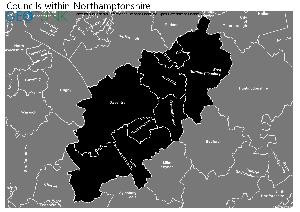
Download Print Quality PDF of Councils in Northamptonshire
Councils Neighbouring Kettering Borough Council
Wards within Kettering Borough Council
click to enlarge
.jpg)
- All Saints
- Avondale Grange
- Barton
- Burton Latimer
- Desborough Loatland
- Desborough St Giles
- Ise Lodge
- Northfield
- Pipers Hill
- Rothwell
- St Michael's and Wicksteed
- St Peter's
- Slade
- Welland
- William Knibb
- Brambleside
- Queen Eleanor and Buccleuch
Download Print Quality PDF of Wards in Kettering Borough Council
Kettering Borough Council Contact Details
| Website | http://www.kettering.gov.uk/ |
| Contact Us Page | http://www.kettering.gov.uk/site/scripts/contact.php |
| Address | Municipal Offices |
| Bowling Green Road | |
| Town | Kettering |
| County | Northamptonshire |
| Postcode | NN15 7QX |
| Telephone Number Description | Customer Services |
| Telephone Number | 01536 410 333 |
| Fax Number | 01536 410 795 |
| Main Contact Email | customerservices@kettering.gov.uk |
Details for Kettering Borough Council
| Local Authority Name | Kettering Borough Council |
| SNAC Code | 34UE |
| Postcode | NN15 7QX |
| Latitude | 52.3957999627 |
| Longitude | -0.726339267519 |
| Country | England |
| NHS Health Authority | East Midlands |
| Parliamentary Constituency | Kettering |
| European Electoral Region | East Midlands |
| Primary Care Trust | Northamptonshire Teaching |
| Region | East Midlands |
| Admin County | Northamptonshire |
| ONS Code | E07000153 |
Waste and Recycling Rates for Kettering Borough Council 2017-18
Waste Recycling Performance
89 (25.87%) of local authorities perform better than Kettering Borough Council.
254 (73.84%) of local authorities perform worse than Kettering Borough Council.

| Authority Type | Collection |
|---|---|
| Waste per household KG | 463.8 |
| Percentage of household waste sent for reuse, recycling or composting | 48.80% |
| Collected household waste per person (kg) | 397.8 |
Employee Headcount for Kettering Borough Council
FTE = Full Time Equivalent
| Region | East Midlands |
|---|---|
| Total Headcount | 515 |
| Total FTE | 466 |
| Male Full Time | 223 |
| Female Full Time | 150 |
| Male Part Time | 12 |
| Female Part Time | 130 |
| Permanent | 512 |
| Temporary/Casual | 3 |
| Male | 235 |
| Female | 280 |
| Full-time | 373 |
| Part-Time | 142 |
| Male Full Time perm | 223 |
| Female Full Time perm | 147 |
| Perm Male | 235 |
| Perm Female | 277 |
| Perm Full-time | 370 |
| Perm Part-time | 142 |
| Male total FTE perm | 232 |
| Female total FTE perm | 231 |
| Male Full Time temp | 0 |
| Female Full Time temp | 3 |
| Temp Male | 0 |
| Temp Female | 3 |
| Temp Full-time | 3 |
| Temp Part-time | 0 |
| Male total FTE temp | 0 |
| Female total FTE temp | 3 |