
Advertisement

Telford & Wrekin Council
Map of the Telford & Wrekin Council Area
The area shaded blue on the map represents the extent of Telford & Wrekin Council. The map pin represents the location of the council offices.
Waste Recycling Performance
168 (48.70%) of local authorities perform better than Telford & Wrekin Council.
176 (51.01%) of local authorities perform worse than Telford & Wrekin Council.
Telford & Wrekin Council has a population of 162,100.
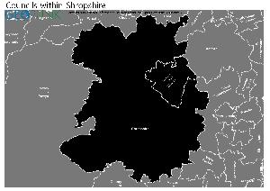
Telford & Wrekin Council is within the ceremonial county of Shropshire
click to enlarge
Download Print Quality PDF of Councils in Shropshire
Councils Neighbouring Telford & Wrekin Council
Wards within Telford & Wrekin Council
click to enlarge
.jpg)
- Admaston & Bratton
- Apley Castle
- Arleston
- Brookside
- Church Aston & Lilleshall
- College
- Dawley & Aqueduct
- Donnington
- Dothill
- Edgmond & Ercall Magna
- Ercall
- Hadley & Leegomery
- Haygate
- Horsehay & Lightmoor
- Ironbridge Gorge
- Ketley & Overdale
- Madeley & Sutton Hill
- Malinslee & Dawley Bank
- Muxton
- Newport North & West
- Newport South & East
- Oakengates & Ketley Bank
- Park
- Priorslee
- St Georges
- Shawbirch
- The Nedge
- Woodside
- Wrockwardine
- Wrockwardine Wood & Trench
Download Print Quality PDF of Wards in Telford & Wrekin Council
Telford & Wrekin Council Contact Details
| Website | http://www.telford.gov.uk |
| Contact Us Page | http://www.telford.gov.uk/contact |
| Address | Addenbrooke House |
| Ironmasters Way | |
| Town | Telford |
| County | Shropshire |
| Postcode | TF3 4NT |
| Telephone Number Description | Switchboard |
| Telephone Number | 01952 380 000 |
| Main Contact Email | contact@telford.gov.uk |
Details for Telford & Wrekin Council
| Local Authority Name | Telford & Wrekin Council |
| SNAC Code | 00GF |
| Postcode | TF3 4NT |
| Latitude | 52.680219666 |
| Longitude | -2.44585827625 |
| Country | England |
| NHS Health Authority | West Midlands |
| Parliamentary Constituency | Telford |
| European Electoral Region | West Midlands |
| Primary Care Trust | Telford and Wrekin |
| Region | West Midlands |
| Admin County | |
| ONS Code | E06000020 |
Waste and Recycling Rates for Telford & Wrekin Council 2017-18
Waste Recycling Performance
168 (48.70%) of local authorities perform better than Telford & Wrekin Council.
176 (51.01%) of local authorities perform worse than Telford & Wrekin Council.

| Authority Type | Unitary |
|---|---|
| Waste per household KG | 609.7 |
| Percentage of household waste sent for reuse, recycling or composting | 43.20% |
| Collected household waste per person (kg) | 456.5 |
Employee Headcount for Telford & Wrekin Council
FTE = Full Time Equivalent
| Region | West Midlands |
|---|---|
| Total Headcount | 6391 |
| Total FTE | 4164 |
| Male Full Time | 678 |
| Female Full Time | 1483 |
| Male Part Time | 524 |
| Female Part Time | 3706 |
| Permanent | 4926 |
| Temporary/Casual | 1465 |
| Male | 1202 |
| Female | 5189 |
| Full-time | 2161 |
| Part-Time | 4230 |
| Male Full Time perm | 587 |
| Female Full Time perm | 1259 |
| Perm Male | 866 |
| Perm Female | 4060 |
| Perm Full-time | 1846 |
| Perm Part-time | 3080 |
| Male total FTE perm | 768 |
| Female total FTE perm | 2885 |
| Male Full Time temp | 91 |
| Female Full Time temp | 224 |
| Temp Male | 336 |
| Temp Female | 1129 |
| Temp Full-time | 315 |
| Temp Part-time | 1150 |
| Male total FTE temp | 117 |
| Female total FTE temp | 394 |