GeoPunk.co.uk
  • Postcode Areas
  • Council Areas
  • STD Dialling Codes
  • Bus Routes
  • Sunrise and Sunset Times
  • Contact Us
  • Privacy Policy
  • Home
  • Post Code Areas
  • OL
Advertisement
GeoPunk

Postcode District: OL Oldham


central coordinates: 53.616159765481,-2.1077490374971

Map of the OL Oldham Postcode Area

map of the OL  Oldham postcode area

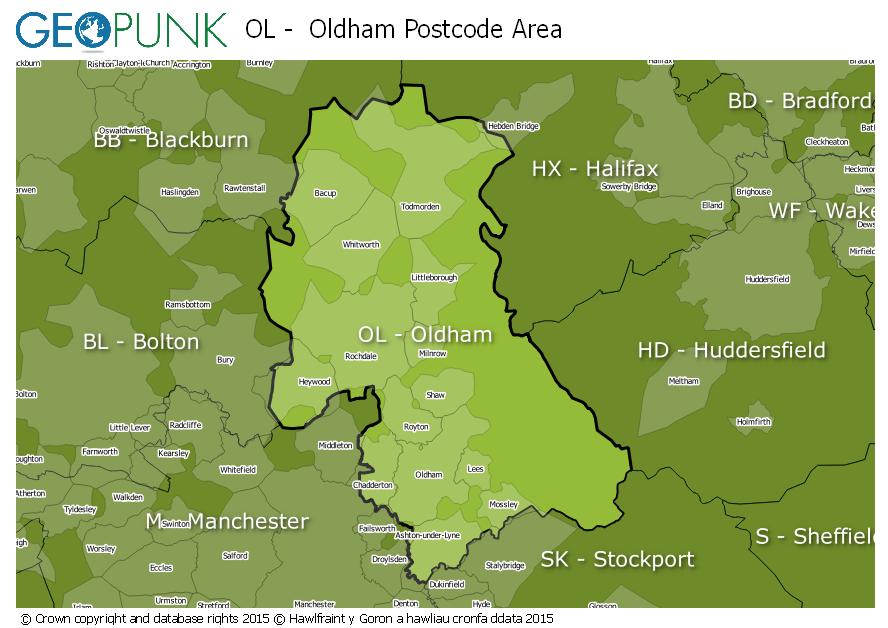
Local Authorities Within the OL Oldham Postcode Area

Kirklees District (B)Manchester District (B)Rossendale District (B)Bury District (B)Oldham District (B)Calderdale District (B)Rochdale District (B)Tameside District (B)High Peak District (B)Burnley District (B)

Postcode Districts within the OL Postcode Area

OL1OL2OL3OL4OL5OL6OL7OL8OL9OL10OL11OL12OL13OL14OL15OL16

Towns and Villages Within the OL Oldham Postcode Area

Ashton-under-lyneBacupHeywoodLittleboroughOldhamRochdaleTodmorden

Postcodes Districts Within the OL Oldham Postcode Area

OL1 1OL1 2OL1 3OL1 4OL2 5OL2 6OL2 7OL2 8OL3 5OL3 6OL3 7OL4 1OL4 2OL4 3OL4 4OL4 5OL5 0OL5 9OL6 6OL6 7OL6 8OL6 9OL7 0OL7 9OL8 1OL8 2OL8 3OL8 4OL9 0OL9 6OL9 7OL9 8OL9 9OL10 1OL10 2OL10 3OL10 4OL11 1OL11 2OL11 3OL11 4OL11 5OL12 0OL12 6OL12 7OL12 8OL12 9OL13 0OL13 8OL13 9OL14 5OL14 6OL14 7OL14 8OL15 0OL15 8OL15 9OL16 1OL16 2OL16 3OL16 4OL16 5


© geopunk 2023

© Crown copyright and database rights 2023

© Hawlfraint y Goron a hawliau cronfa ddata 2023